Geophysical Atlas of the East Greenland Basins
Compiled and edited by Mikal Trulsvik, Sverre Planke, Stephane Polteau and Reidun Myklebust.

The Atlas is a comprehensive interpretation project based on the integrated seismic, gravity and magnetic (SGM) interpretation method. Focus is on the northeast Greenland margin and the 2012/2013 licensing round areas. The Atlas is a complete revision of the 2007-edition, and all available TGS seismic (NEG08/09 and reprocessed AWI 99/02/03) and airborne magnetic (NEGAM07/08) and gravity data (NEGAG07/08, NEG/AWI line data) were used to evaluate the structure and development of the NE Greenland margin.
Highlights
- Onshore geology compiled and edited by GEUS
- Map interpretations based on bathymetry, airborne magnetic and gravity surveys, and complex anomaly analyses
- Magnetic and gravity anomaly interpretations
- Nomenclature map for the whole East Greenland margin
- Euler 3D depths to magnetic sources
- Seismic interpretations supported by airborne magnetic and gravity line data
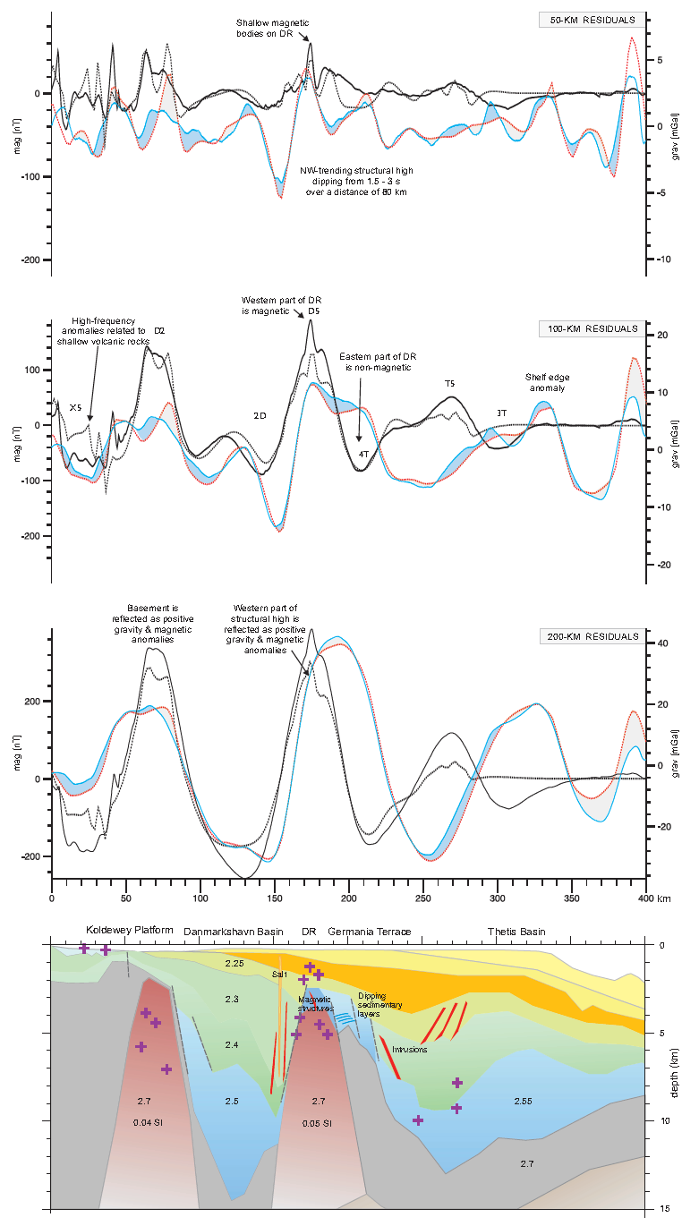
- 11 gravity/magnetic modeling transects across key anomalies
- Basin modeling and assessment of hydrocarbon maturation potential across Danmarkshavn and Thetis basins using TecMod2D
- Plate tectonic reconstruction and conjugate margin interpretation
- Continent-ocean transition evaluation
- Volcanic complex and sill intrusions
- Petroleum implications of sill intrusions
The main focus of the atlas are:
- petroleum potential of the sub-basalt acreage
- to increase knowledge and understanding of the process that control breakup-related volcanism and their effect on the petroleum system
- to give comprehensive overview of the structure and development of the outer Møre and Vøring basins based on SGM interpretation
- seismic volcanostratigraphy for improved interpretation of basalt and sub-basalt prospects
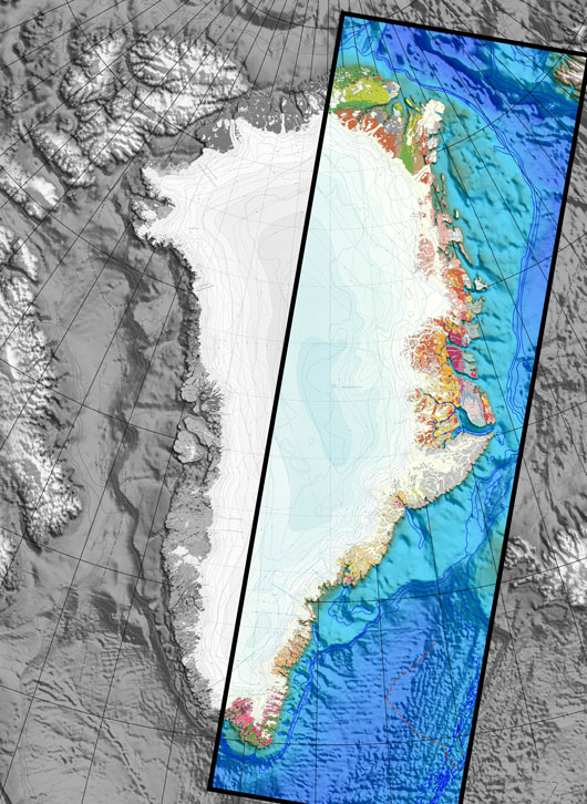
Map highlighting the area covered in the Atlas.
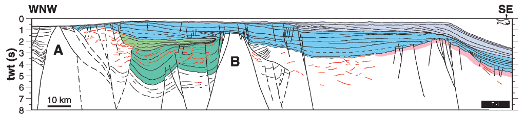
Geoseismic section NE Greenland
CONTENTS
Introduction
- Executive Summary
- Geological Framework
- Greenland Maps
- Northeast Atlantic
Northern East Greenland
- Regional Maps
- Thetis and Trolle Land Margins
- Liverpool Land and Foster Margins
Southeast Greenland
Appendix
Modelling
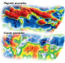
Grav-Mag anomalies
![]()