Geophysical Atlas of the Sea of Okhotsk

Compiled and edited by Øyvind Engen, Sverre Planke, Reidun Myklebust, Frode Sandnes, and Erling Frantzen.


The Atlas presents integrated SGM interpretations of regional geology and individual basin structures. Case studies convey new understanding of the geological setting of the Sakhalin petroleum province as well as underexplored petroleum systems in the central and northern Sea of Okhotsk.

-  Data specific processing, inversion and interpretation
-  Qualitative integrated interpretation in seismic workstation environment
-  Case studies/quantitative modeling of basins and potential field anomalies

RELATED PRODUCTS

Geophysical Atlases

okhotsk provinces1000

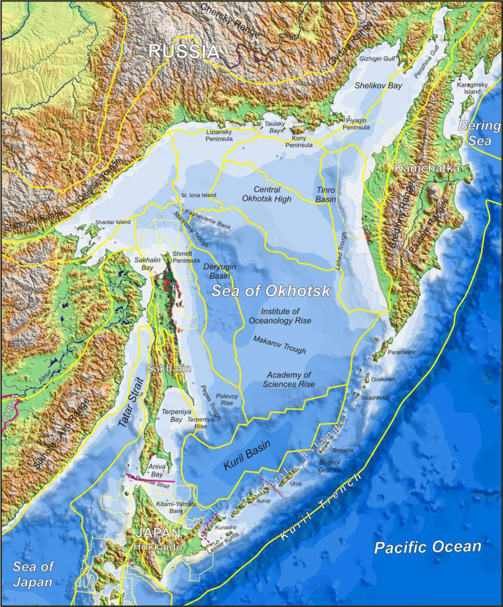
Bathymetric map showing the Sea of Okhotsk and surrounding areas.


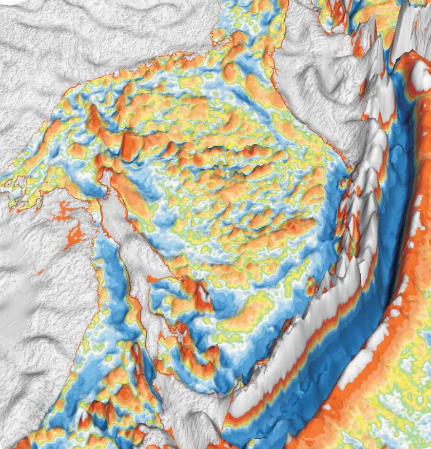
High-pass filtered Bouguer gravity data

CONTENTS


Synthesis and Conclusions

  • Executive Summary
  • Geological Framework
  • Petroleum Systems

Regional Maps and Profiles

  • Geophysical Maps
  • Crustal Provinces and Regional SGM Profiles

Sakhalin Region

  • Geophysical Maps
  • Integrated SGM Interpretation and Modeling


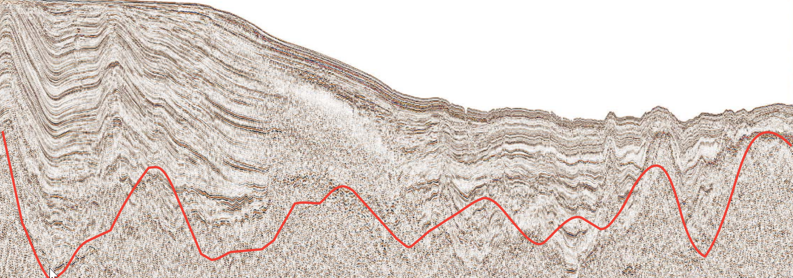
West-east seismic and gravity profile across the Deryugin Basin

Magadan Region

  • Geophysical Maps
  • Integrated SGM Interpretation and Modeling

West Kamchatka Region

  • Geophysical Maps
  • Integrated SGM Interpretation and Modeling

Data, Methods, and References