CONTENTS
Executive Summary
Introduction
• Aim
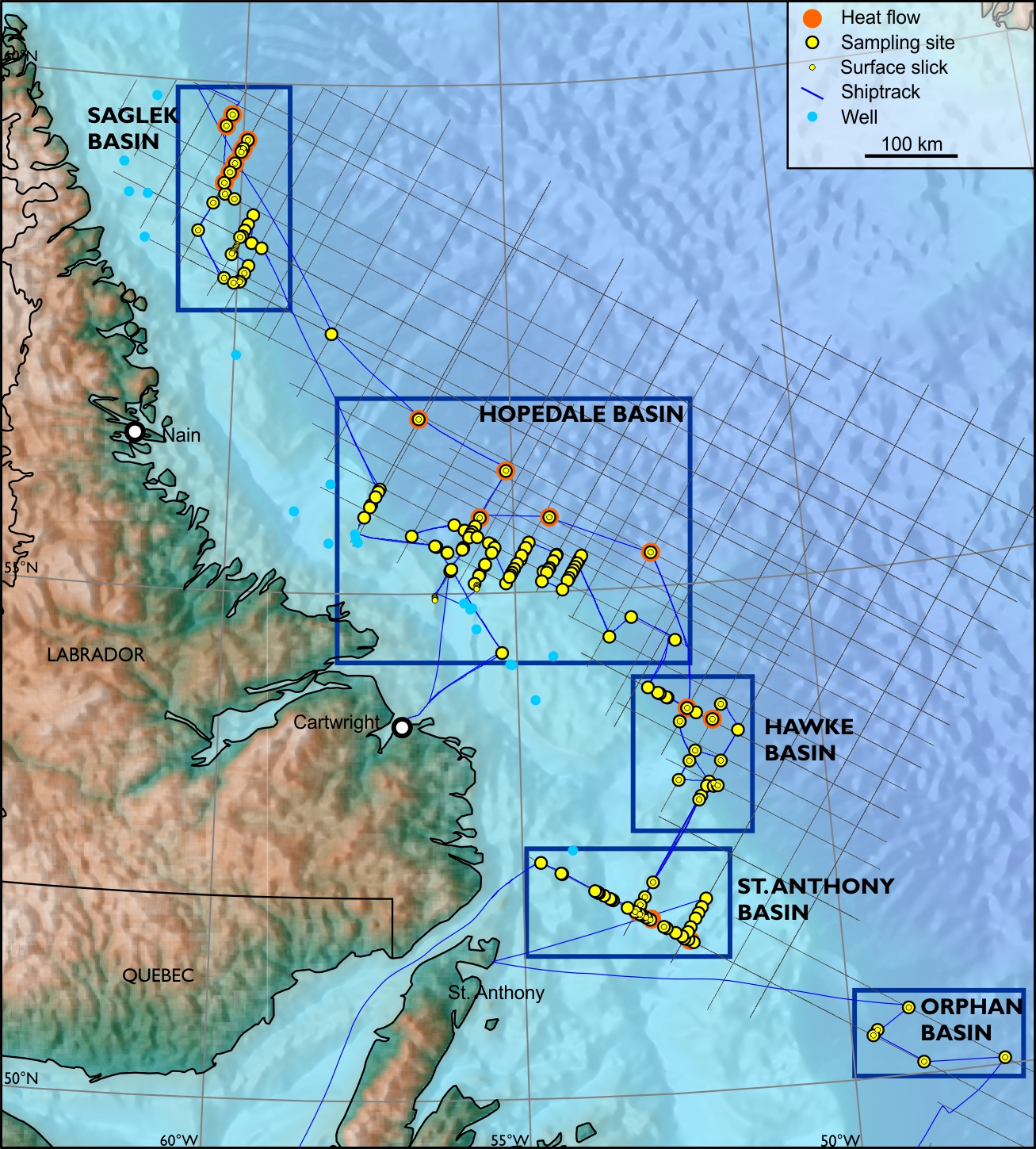
• Sampling Strategy
• Geological Framework
Operations
• Overview
• Vessel
• Sampling Procedures
• Temp. and Thermal Cond.
• Surface Slicks
Explanatory Notes
• Navigation
• Sub-Bottom Profiler (SBP)
• Sample Handling
• Geochemistry
• MPOG
• Geoth. Grad. and Heat Flow
Results
• Standard Organic Geochemistry
• AGI
• MPOG
• Slick Sample Analysis
• Heat Flow and Geothermal Gradient
Integration and Conclusions
• Measuring Range
• Method Sensitivities
• Petroleum Systems
• Heat Flow and Thermal Gradient
• Conclusions
Bibliography
Appendix A - Core Descriptions
Appendix B - Original Lab Reports
Appendix C - Data Report
Digital Data