P-Cable | Barents Sea
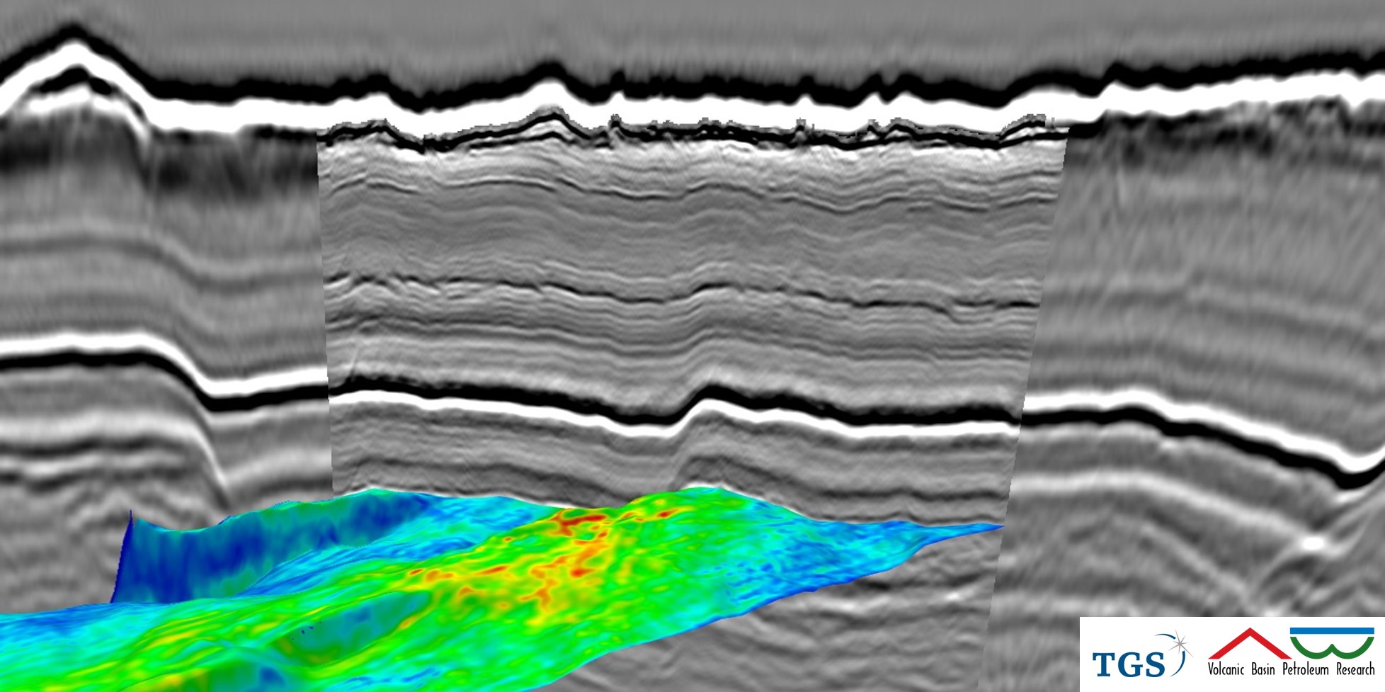
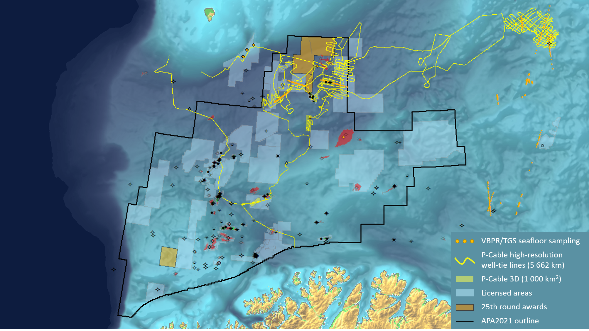
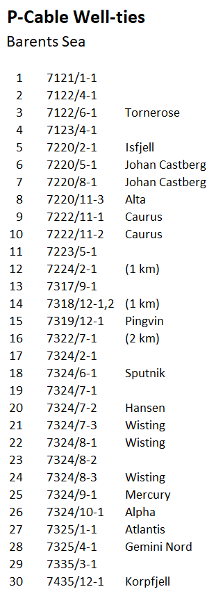
Our multi-client library consists of 15 high-resolution 3D cubes and more than 5600 km of wide-azimuth 2D P-Cable seismic profiles. The surveys are located in the Norwegian Barents Sea, providing high resolution well ties to 30 key exploration wells, a high number of shallow NPD wells, and to our extensive Seafloor Sampling programs.
The focus of the acquisition was on Fingerdjupet/Hoop (HR14) and the Barents SE (HR15) areas for the 22nd and 23rd licensing round, but still offer valuable stratigraphic correlations to untested opportunities in the new 25R licenses and in the ongoing APA21 licensing round.
The data has been acquired in collaboration with TGS and WGP Survey. Please contact us or TGS for more details on the available data.

Multi-Client P-Cable Data
HR_15
High-resolution P-Cable 3D and 2D data in the Barents Sea (2015; mainly South East area), TGS ClariFiTM processed.
| Survey Name | Description | Size |
| HR15_3D_BSSE1 | HiRes 3D, Barents Sea South East, Haapet Dome | 72 km2 |
| HR15_3D_BSSE2 | HiRes 3D, Barents Sea South East, Haapet Dome | 71 km2 |
| HR15_3D_BSSE3 | HiRes 3D, Barents Sea South East, Haapet Dome | 25 km2 |
| HR15_3D_BSSE3 | HiRes 3D, Barents Sea South East, Haapet Dome | 50 km2 |
| HR15_3D_7322 | HiRes 3D, Barents Sea, Fingerdjupet Sub-basin | 53 km2 |
| HR15_2D_BS | HiRes 2D, Eastern Barents Sea | 4177 km |
| HR15_2D_MN | HiRes 2D, Mid Norwegian Continental Shelf | 1108 km |
HR_14
High-resolution P-Cable 3D and 2D data in the Barents Sea (2014; mainly Hoop area), TGS ClariFiTM processed.
| Survey Name | Description | Size |
| HR14_3D_HFCE1 | HiRes 3D, Barents Sea, Hoop Fault Complex East | 181 km2 |
| HR14_3D_HFCE2 | HiRes 3D, Barents Sea, Hoop Fault Complex East | 50 km2 |
| HR14_3D_HFCW1 | HiRes 3D, Barents Sea, Hoop Fault Complex West | 31 km2 |
| HR14_3D_HFCE3 | HiRes 3D, Barents Sea, Hoop Fault Complex West | 17 km2 |
| HR14_3D_HFCE4 | HiRes 3D, Barents Sea, Hoop Fault Complex West | 28 km2 |
| HR14_3D_7324_10 | HiRes 3D, Barents Sea, Bjarmenland Platform | 124 km2 |
| HR14_2D | HiRes 2D, Barents Sea South | 1486 km |
HR_12
High-resolution 3D data covering the Barents Sea (2012: mainly Hoop area)
| Survey Name | Description | Size |
| HR12_3D-A | HiRes 3D, Barents Sea, Hoop Fault Complex East | 21 km 2 |
| HR12_3D-B | HiRes 3D, Barents Sea, Hoop Fault Complex East | 19 km 2 |
| HR12_3D-C | HiRes 3D, Barents Sea, Hoop Fault Complex West | 14 km 2 |
| HR12_3D-D | HiRes 3D, Barents Sea, Hoop Fault Complex West | 12 km2 |


